
We’re excited to announce the release of XPFlightPlanner 4.10, bringing new mapping capabilities, airport weather information, improved map readability, and support for additional languages.
This update focuses on making flight planning more intuitive and accessible, whether you’re preparing a short VFR flight or planning a complex IFR route in X-Plane 11 or 12.
Satellite Maps
One of the highlights of version 4.10.0 is the introduction of satellite maps.
In addition to the existing map styles, you can now switch to satellite imagery to explore airports, terrain, coastlines, and surrounding landscapes.
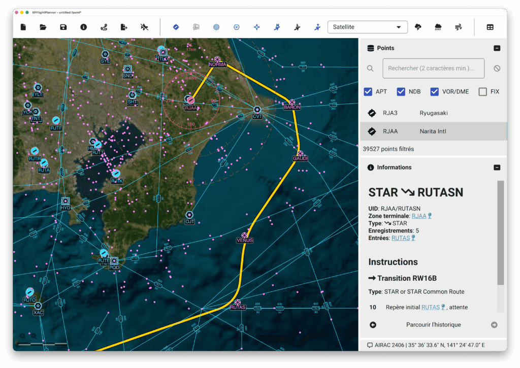
Satellite maps offer a different perspective when planning your flights, particularly for VFR navigation and flights through mountainous or coastal regions.
Whether you’re planning an approach into a challenging airport or simply exploring your next destination, satellite imagery adds a new dimension to your flight planning experience.
Airport METAR
Weather is an essential part of flight planning, and XPFlightPlanner 4.10.0 makes it easier to access airport weather information.
You can now view the latest available METAR reports directly from airports in XPFlightPlanner.
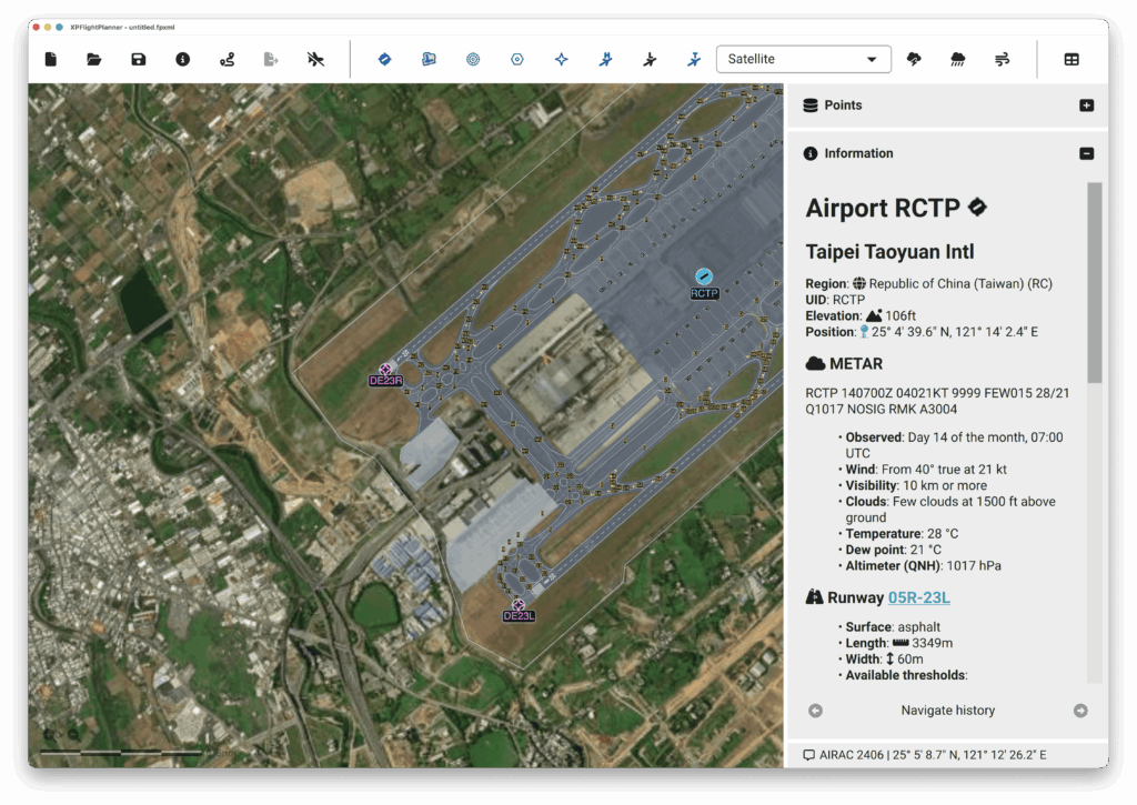
METAR reports provide valuable information about current airport weather conditions, including wind, visibility, cloud cover, temperature, and atmospheric pressure.
This addition allows you to quickly check airport weather conditions while building your flight plan, without switching between different applications or websites.
Improved map readability
We’ve also introduced several improvements to make the XPFlightPlanner map clearer and more comfortable to use.
Map colors have been refined and adapted to the selected map style, improving the contrast and visibility of aviation information.
Airports, navigation aids, airways, and flight routes are now easier to distinguish from the map background.
These improvements are particularly noticeable when switching between different map styles, helping you focus on the information that matters most during flight planning.
Multilingual support!
XPFlightPlanner is used by flight simulation enthusiasts around the world, and we’re making it more accessible to our international community.
Starting with version 4.10.0, XPFlightPlanner is available in four languages:
- 🇬🇧 English
- 🇫🇷 French
- 🇩🇪 German
- 🇪🇸 Spanish
These new translations make it easier for more virtual pilots to navigate the application and take advantage of its flight planning features.
We hope this will make XPFlightPlanner even more welcoming to flight simulation enthusiasts worldwide.
Additional Fixes and Improvements
Alongside these new features, version 4.10.0 includes several bug fixes related to flight plan exports.
VATSIM Flight Plan Export
We’ve corrected an issue affecting route information when exporting flight plans for VATSIM.
The aircraft wake turbulence category is now correctly included in exported flight plans, ensuring more accurate aircraft information.
Important news for XPCharts users
As part of our efforts to simplify our software lineup and focus development on a single flight planning application, XPCharts has been discontinued.
If you’re still using XPCharts, we encourage you to switch to XPFlightPlanner.
The good news is that the free version of XPFlightPlanner includes all the features previously available in XPCharts, so you can continue enjoying the same functionality without purchasing a license.
By moving to XPFlightPlanner, you’ll also benefit from an actively maintained application, regular updates, and additional flight planning capabilities.
Download XPFlightPlanner 4.10
XPFlightPlanner 4.10.0 is available now for Windows, macOS, and Linux.
If you’re already using XPFlightPlanner, you can update to the latest version. New users can download the application and start exploring its features for free.
We’d love to hear what you think about the new satellite maps, METAR information, and improved map styles. Your feedback helps us continue improving XPFlightPlanner and bringing new features to the flight simulation community.
Thank you for your continued support!
Happy flight planning and blue skies! ✈️